 Fort Taber National Register Historic District
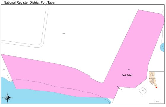
The Fort Taber National Register Historic District includes approximately 11 acres of land, the granite-faced Fort Taber and five Endicott-period batteries, built largely in the late 1890s, recall the defensive philosophy and technology of the Endicott era.
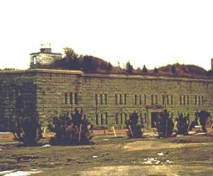
The southeastern facing Fort Taber is still structurally sound and in fair condition. The seven sided polygon is approximately 711 feet in exterior circumference with a five-sided interior court measurement about 160 feet from northeast to southwest and 45 feet northwest to southeast. Equivalent to three stories in height, the fort has two casemate levels and is constructed largely of hand-cut rectangular granite blocks laid in a coursed pattern. All six seaward elevations of the fort are broken by Totten-class embrasures. Although not the first gun ports of their kind installed on an American fort, they may be, according to the Fort Taber Historical Association, the only ports in the New England region. Breaking the north elevation are small arms loopholes, the structure’s only entrance-a massive, pilastered and pedimented sally port-and a small, gable-roofed support building that was attached to the fort sometime prior to mid-century.
Erected on the shoreline between 1898 and 1901, the Endicott-period batteries flank Fort Taber on its northeast and northwest sides. All these massive structures are made of reinforced concrete, faced with earth, and fitted with iron and steel hardware. None of the emplacements retains its armament.